Jan Mayen
The island
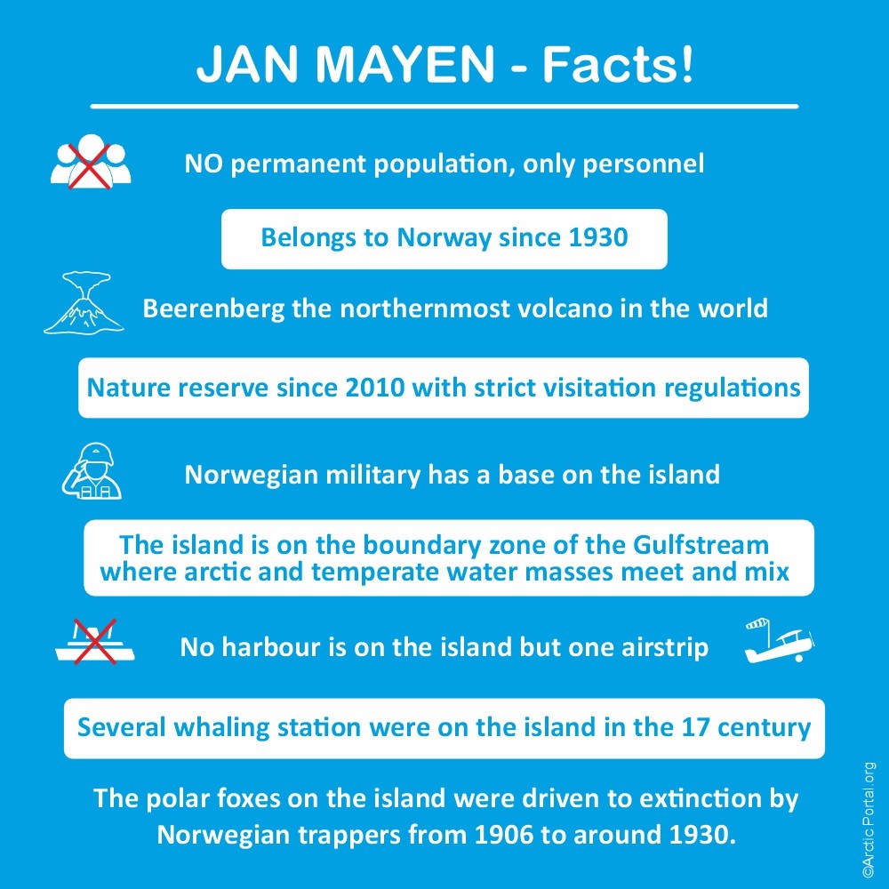
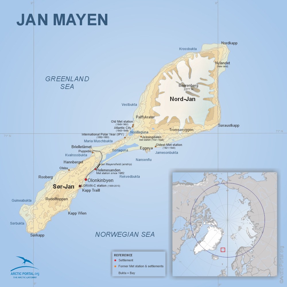
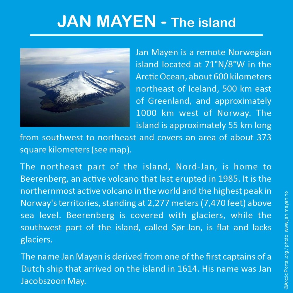
Jan Mayen is a remote Norwegian island located at 71°N/8°W in the Arctic Ocean, about 600 kilometers northeast of Iceland, 500 km east of Greenland, and approximately 1000 km west of Norway. The island is approximately 55 km long from southwest to northeast and covers an area of about 373 square kilometers (see map).
The northeast part of the island, Nord-Jan, is home to Beerenberg, an active volcano that last erupted in 1985. It is the northernmost active volcano in the world and the highest peak in Norway's territories, standing at 2,277 meters (7,470 feet) above sea level. Beerenberg is covered with glaciers, while the southwest part of the island, called Sør-Jan, is flat and lacks glaciers.
The name Jan Mayen is derived from one of the first captains of a Dutch ship that arrived on the island in 1614. His name was Jan Jacobszoon May.
History
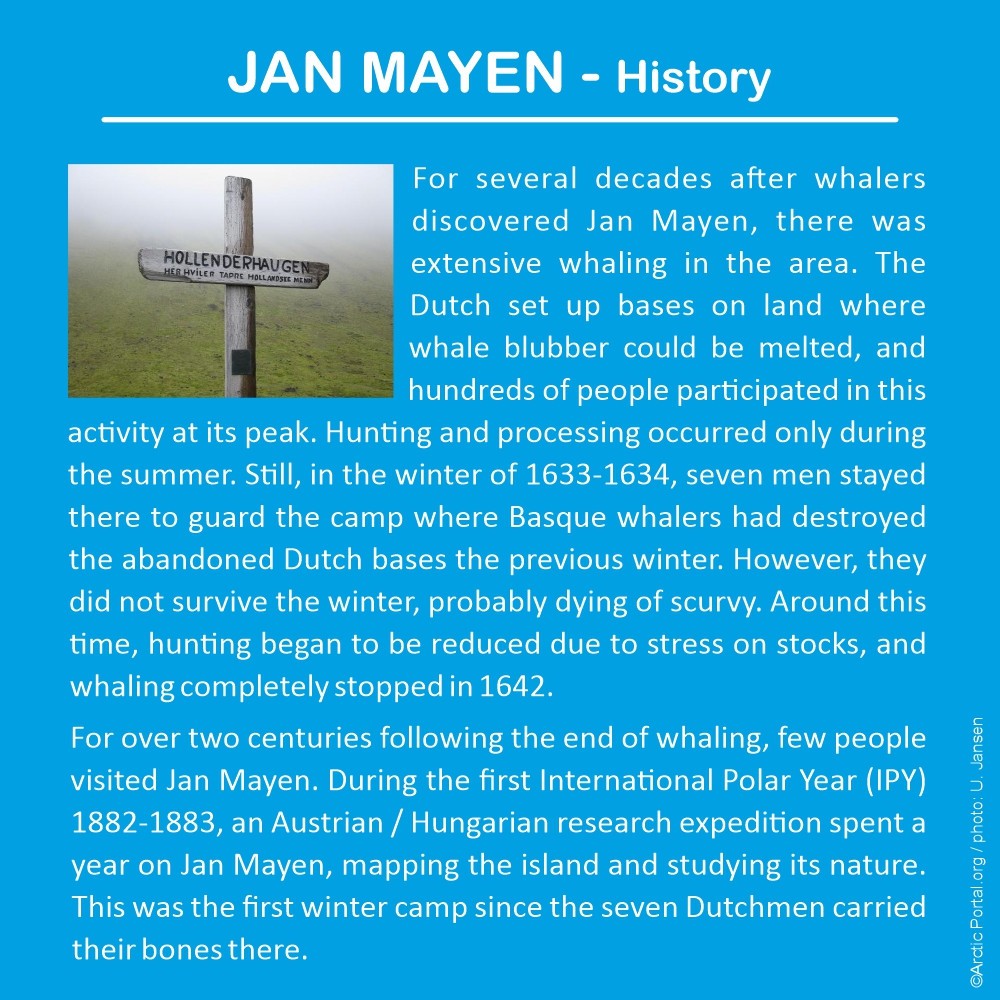
For several decades after whalers discovered Jan Mayen, there was extensive whaling in the area. The Dutch set up bases on land where whale blubber could be melted, and hundreds of people participated in this activity at its peak. Hunting and processing occurred only during the summer. Still, in the winter of 1633-1634, seven men stayed there to guard the camp where Basque whalers had destroyed the abandoned Dutch bases the previous winter. However, they did not survive the winter, probably dying of scurvy. Around this time, hunting began to be reduced due to stress on stocks, and whaling completely stopped in 1642.
For over two centuries following the end of whaling, few people visited Jan Mayen. During the first International Polar Year (IPY) 1882-1883, an Austrian / Hungarian research expedition spent a year on Jan Mayen, mapping the island and studying its nature. This was the first winter camp since the seven Dutchmen carried their bones there.
Activities on the island
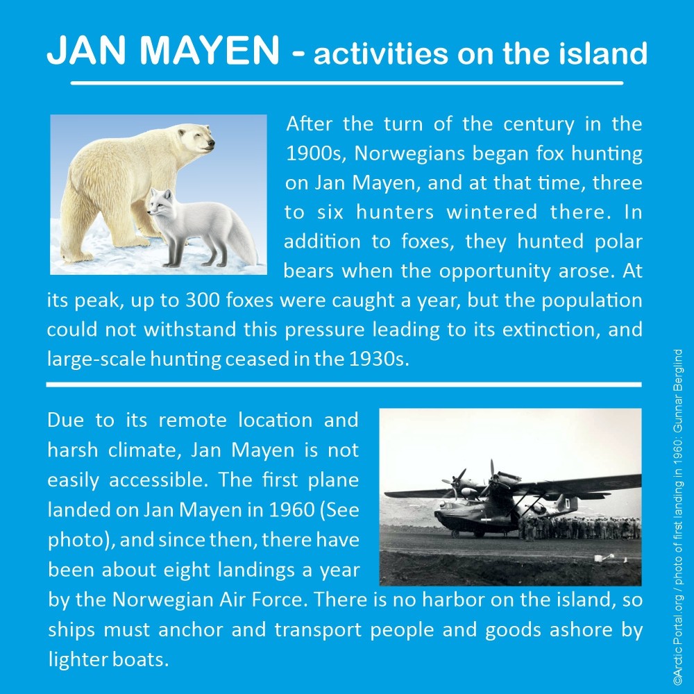
After the turn of the century in the 1900s, Norwegians began fox hunting on Jan Mayen, and at that time, three to six hunters wintered there. In addition to foxes, they hunted polar bears when the opportunity arose. At its peak, up to 300 foxes were caught a year, but the population could not withstand this pressure leading to its extinction, and large-scale hunting ceased in the 1930s.
Due to its remote location and harsh climate, Jan Mayen is not easily accessible. The first plane landed on Jan Mayen in 1960 (See photo), and since then, there have been about eight landings a year by the Norwegian Air Force. There is no harbor on the island, so ships must anchor and transport people and goods ashore by lighter boats.
Settlements
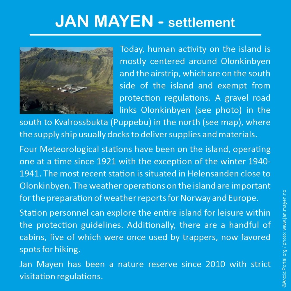
Today, human activity on the island is mostly centered around Olonkinbyen and the airstrip, which are on the south side of the island and exempt from protection regulations. A gravel road links Olonkinbyen (see photo) in the south to Kvalrossbukta (Puppebu) in the north (see map), where the supply ship usually docks to deliver supplies and materials.
Four Meteorological stations have been on the island, operating one at a time since 1921 with the exception of the winter 1940-1941. The most recent station is situated in Helensanden close to Olonkinbyen. The weather operations on the island are important for the preparation of weather reports for Norway and Europe.
Station personnel can explore the entire island for leisure within the protection guidelines. Additionally, there are a handful of cabins, five of which were once used by trappers, now favored spots for hiking.
Jan Mayen has been a nature reserve since 2010 with strict visitation regulations.
See also our map of Arctic Definitions
Visit our Map Gallery Arctic Portal specializes in creating customized graphical maps that cover a range of significant Arctic topics with global recognition. We are continuously working on new maps and adding them to our Gallery.