Ellesmere Island
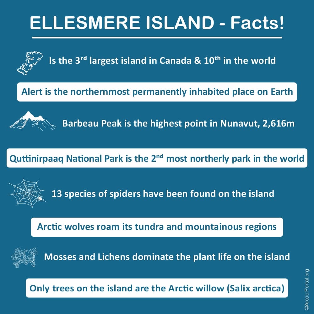
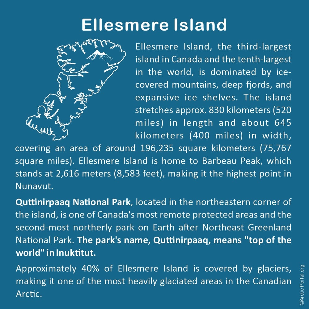
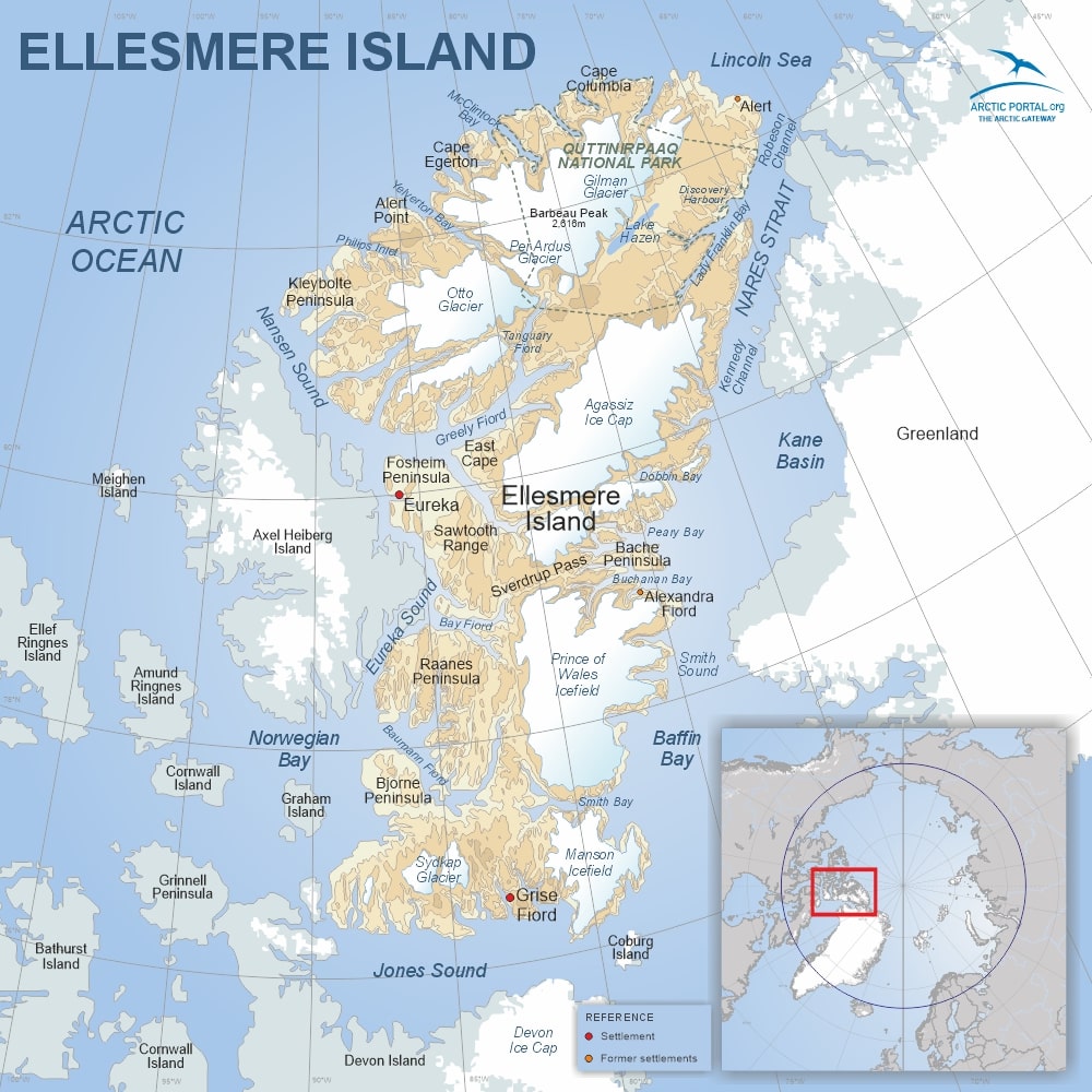
Ellesmere Island, the third-largest island in Canada and the tenth-largest in the world, is dominated by ice-covered mountains, deep fjords, and expansive ice shelves. The island stretches approx. 830 kilometers (520 miles) in length and about 645 kilometers (400 miles) in width, covering an area of around 196,235 square kilometers (75,767 square miles). Ellesmere Island is home to Barbeau Peak, which stands at 2,616 meters (8,583 feet), making it the highest point in Nunavut.
Quttinirpaaq National Park, located in the northeastern corner of the island, is one of Canada's most remote protected areas and the second-most northerly park on Earth after Northeast Greenland National Park. The park's name, Quttinirpaaq, means "top of the world" in Inuktitut.
Approximately 40% of Ellesmere Island is covered by glaciers, making it one of the most heavily glaciated areas in the Canadian Arctic.
Discovery & Early Exploration
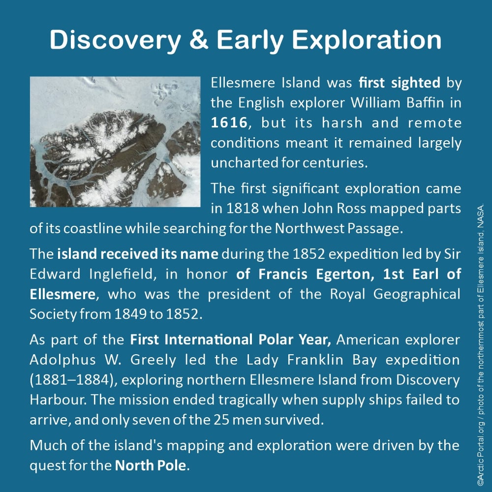
Ellesmere Island was first sighted by the English explorer William Baffin in 1616, but its harsh and remote conditions meant it remained largely uncharted for centuries.
The first significant exploration came in 1818 when John Ross mapped parts of its coastline while searching for the Northwest Passage.
The island received its name during the 1852 expedition led by Sir Edward Inglefield, in honor of Francis Egerton, 1st Earl of Ellesmere, who was the president of the Royal Geographical Society from 1849 to 1852.
As part of the First International Polar Year, American explorer Adolphus W. Greely led the Lady Franklin Bay expedition (1881–1884), exploring northern Ellesmere Island from Discovery Harbour. The mission ended tragically when supply ships failed to arrive, and only seven of the 25 men survived.
Much of the island's mapping and exploration were driven by the quest for the North Pole.
Indigenous Presence
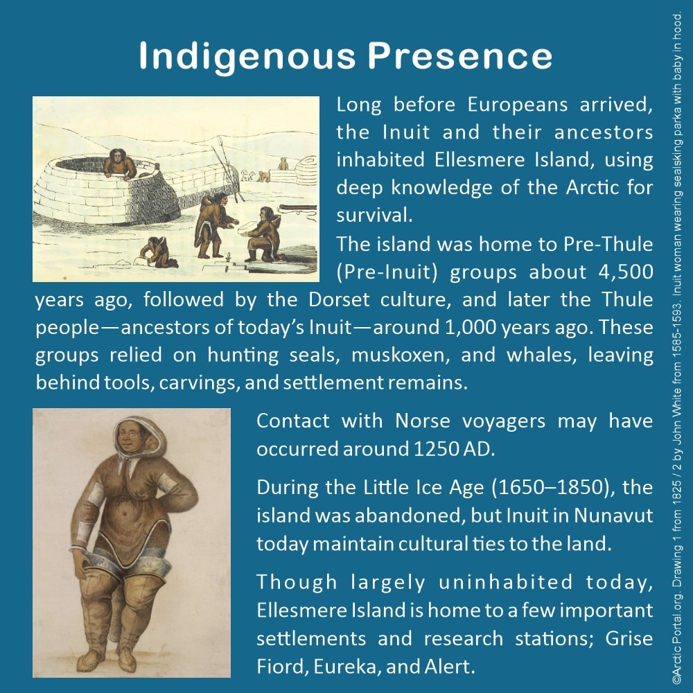
Long before Europeans arrived, the Inuit and their ancestors inhabited Ellesmere Island, using deep knowledge of the Arctic for survival.
The island was home to Pre-Thule (Pre-Inuit) groups about 4,500 years ago, followed by the Dorset culture, and later the Thule people—ancestors of today’s Inuit—around 1,000 years ago. These groups relied on hunting seals, muskoxen, and whales, leaving behind tools, carvings, and settlement remains.
Contact with Norse voyagers may have occurred around 1250 AD.
During the Little Ice Age (1650–1850), the island was abandoned, but Inuit in Nunavut today maintain cultural ties to the land.
Though largely uninhabited today, Ellesmere Island is home to a few important settlements and research stations: Grise Fiord, Eureka, and Alert.
Wildlife of Ellesmere Island
Ellesmere Island hosts a range of Arctic wildlife uniquely adapted to its extreme conditions.
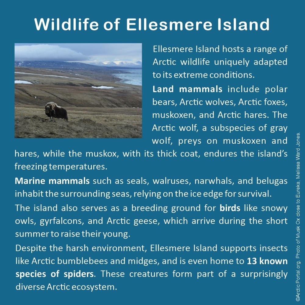
Land mammals include polar bears, Arctic wolves, Arctic foxes, muskoxen, and Arctic hares. The Arctic wolf, a subspecies of gray wolf, preys on muskoxen and hares, while the muskox, with its thick coat, endures the island’s freezing temperatures.
Marine mammals such as seals, walruses, narwhals, and belugas inhabit the surrounding seas, relying on the ice edge for survival.
The island also serves as a breeding ground for birds like snowy owls, gyrfalcons, and Arctic geese, which arrive during the short summer to raise their young.
Despite the harsh environment, Ellesmere Island supports insects like Arctic bumblebees and midges, and is even home to 13 known species of spiders. These creatures form part of a surprisingly diverse Arctic ecosystem.
See also our map of Arctic Definitions
Visit our Map Gallery Arctic Portal specializes in creating customized graphical maps that cover a range of significant Arctic topics with global recognition. We are continuously working on new maps and adding them to our Gallery.