
News
Man missing - Seismic and volcanic activity in Iceland continues with serious consequences
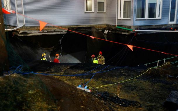
A construction worker, working on compacting gravel filling in a fissure in the town of Grindavik is missing after the earth collapsed from under him yesterday morning, Wednesday the 10th. The town was evacuated in November 2023 because of volcanic activity. It has been slowly coming back to life not least due to pressure from both economic and social aspects despite imminent hazards.
Search for the man is still underway, unfortunately still without any results. Rescue workers who have been lowered in to search have discovered that the fissure, which looks relatively harmless on the surface, is actually widening sharply just below the surface and is estimated to be as deep as 20-30 meters.
At the bottom, the fissure is filled with many meters deep groundwater or seawater, as they mark flood and tide effects on the water and its clarity. Underwater drones are used to aid the search efforts.
The incident has seriously shaken the inhabitants, some of whom have already moved back or have been planning and pressing authorities to lift all restrictions, as this shows clearly the uncertainty and seriousness of the surface conditions after the recent and ungowning seismic activity.
The event raises questions about whether it is safe enough or even logical at all to allow people back to live in the community under the current situation.
All restructuring work that has been going on has been halted until next week while scientists and authorities review the conditions.

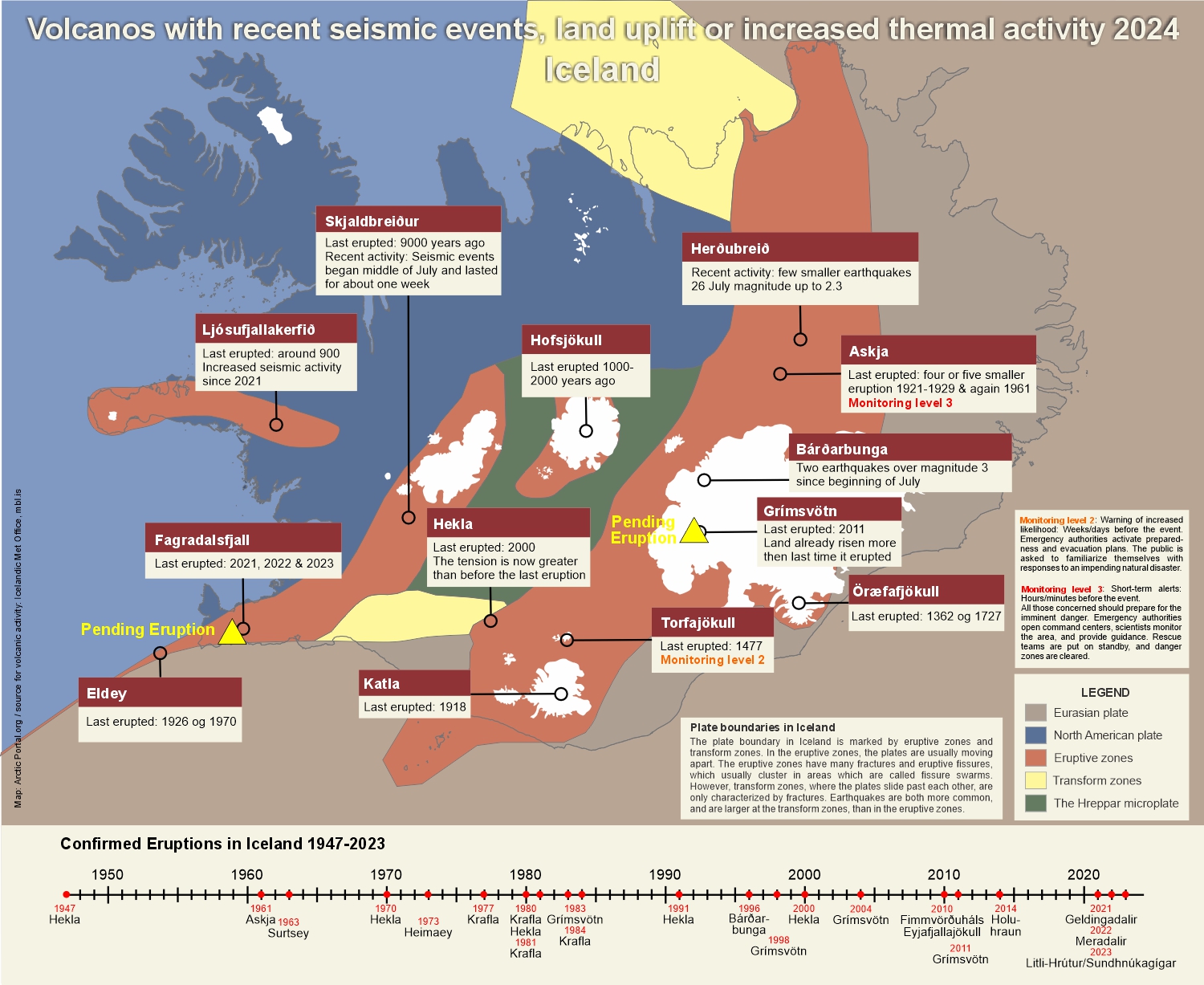
Further, the Met Office has indicated an increased risk of an eruption in the coming days. They have announced a yellow warning for aviation over Vatnajökull glacier as the volcano Grímsvötn is showing some signs of a pending eruption (see map). See their notice below on the condition by Grindavík and the accompanying map.
From the Met Office of Iceland:
Seismic activity continues to exhibit a pattern similar to that of recent days. The earthquake activity remains relatively low, primarily centered between Hagafell and Stóra Skógfell, where the center of the intrusion is situated. Additionally, there is ongoing seismic activity in Fagradalsfjall, persisting since December 18th.
Land uplift is still being measured in the Svartsengi area, exhibiting a relatively stable trend since the eruption on December 18th. The accompanying image, marked with red dots representing data from the GPS station SENG in Svartsengi, illustrates this trajectory The recent rate of uplift is approximately 5 mm per day, resulting in a current elevation that is about 5 cm higher than before the dike intrusion on November 10th and December 18th last year.

Calculations from models relying on deformation measurements (GPS and satellite images) indicate that the amount of magma accumulated in the reservoir beneath Svartsengi has reached a level comparable to the volume that led to the formation of the magma conduit and the subsequent eruption on December 18th last year. This suggests that there is an increased risk of an eruption in the coming days.
The Icelandic Meteorological Office issued an updated hazard map on January 5th, and it will be reassessed on January 12th.
Text: Arctic Portal.org
Map of Iceland: Arctic Portal.org
The tags below provide an opportunity to view previously posted related news within the selected category