
Arctic Sea Ice Extent February 2015
This map shows the sea ice extent at its winter highest in February 2015, and the February median line 1981-2010.
Additional maps are available for the period from 1979 to 2015; please contact info at arcticportal.org.
© Arctic Portal 2006-2026
Last updated: April 2016
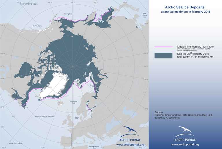
Source
NSIDC