Arctic Countries and Islands
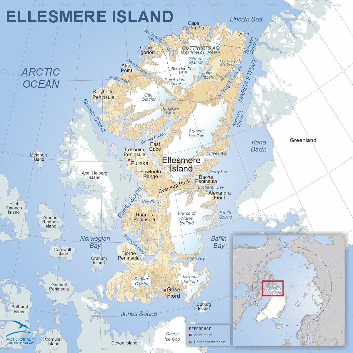
Ellesmere Island, the third-largest island in Canada and the tenth-largest in the world, is dominated by ice-covered mountains, deep fjords, and expansive ice shelves. The island stretches approx. 830 kilometers (520 miles) in length and about 645 kilometers (400 miles) in width, covering an area of around 196,235 square kilometers (75,767 square miles). Ellesmere Island is home to Barbeau Peak, which stands at 2,616 meters (8,583 feet), making it the highest point in Nunavut.
© Arctic Portal 2006-2026
Last updated: April 2025
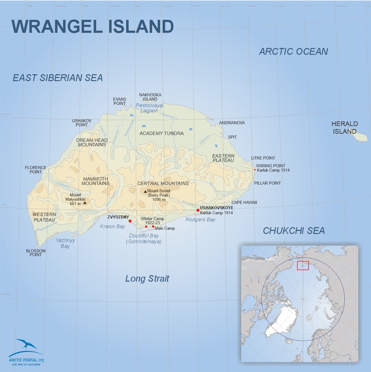
Wrangel Island is about 150 km (93mi) long from east to west and 80km (50mi) wide from north to south, spans approximately 7,600 square kilometers (2,900 square miles) and is located at a latitude of about 71°N and a longitude of 179°W. This remote Russian island, located between the Chukchi Sea and the East Siberian Sea, is a UNESCO World Heritage Site and one of the most remarkable Arctic nature reserves.
© Arctic Portal 2006-2026
Last updated: March 2025
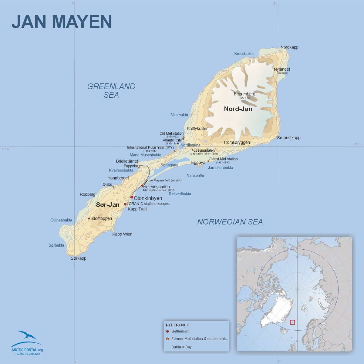
This is a map of Jan Mayen. Jan Mayen is a remote Norwegian island located at 71°N/8°W in the Arctic Ocean, about 600 kilometers northeast of Iceland, 500 km east of Greenland, and approximately 1000 km west of Norway. The island is approximately 55 km long from southwest to northeast and covers an area of about 373 square kilometers (see map).
The northeast part of the island, Nord-Jan, is home to Beerenberg, an active volcano that last erupted in 1985. It is the northernmost active volcano in the world and the highest peak in Norway's territories, standing at 2,277 meters (7,470 feet) above sea level. Beerenberg is covered with glaciers, while the southwest part of the island, called Sør-Jan, is flat and lacks glaciers.
© Arctic Portal 2006-2026
Last updated: February 2025
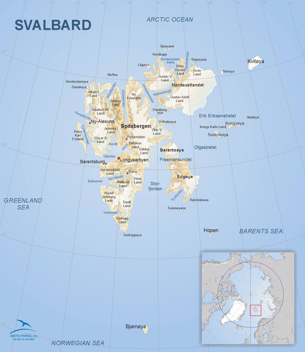
This is a map of Svalbard. Svalbard is a Norwegian glaciated Arctic archipelago covering approximately 61,000 square kilometers, with around 60% of its landmass covered by ice. It has a small population of around 2,500, mainly in Longyearbyen, the largest settlement. Known for its glaciers, polar bears, and the Svalbard Global Seed Vault, it plays a key role in Arctic research and geopolitics.
© Arctic Portal 2006-2026
Last updated: February 2025
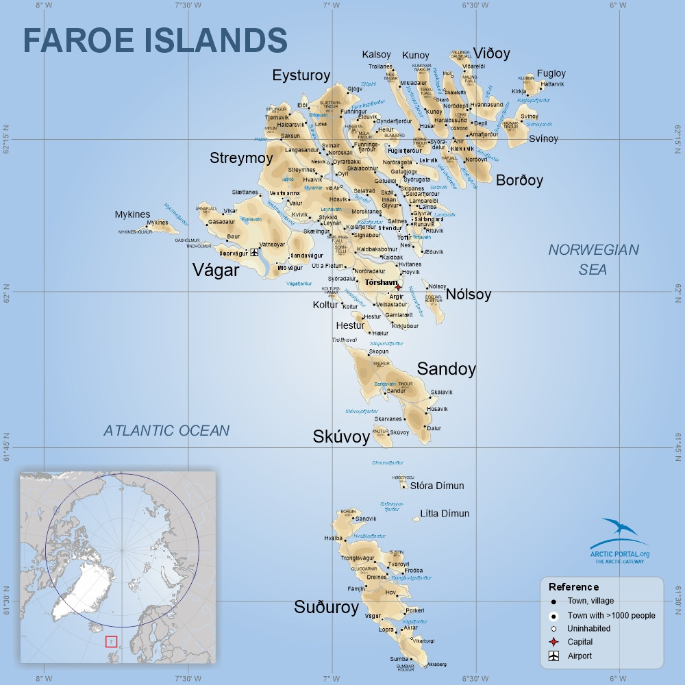
This is a map of the Faroe Islands. The Faroe Islands, a cluster of 18 rugged islands, lie between the Norwegian Sea and the North Atlantic, about halfway between Iceland and Norway at coordinates 62°N, 7°W.
Their isolated location and dramatic landscapes include Europe’s highest sea cliffs, rolling green hills, fjords, small lakes, rivers, and 1,117 kilometers of coastline across 1,393 km2. The highest point is Slættaratindur at 882 m on the island of Eysturoy.
Tórshavn is the capital located on the island of Streymoy with about 23 thousand inhabitants.
© Arctic Portal 2006-2026
Last updated: February 2025
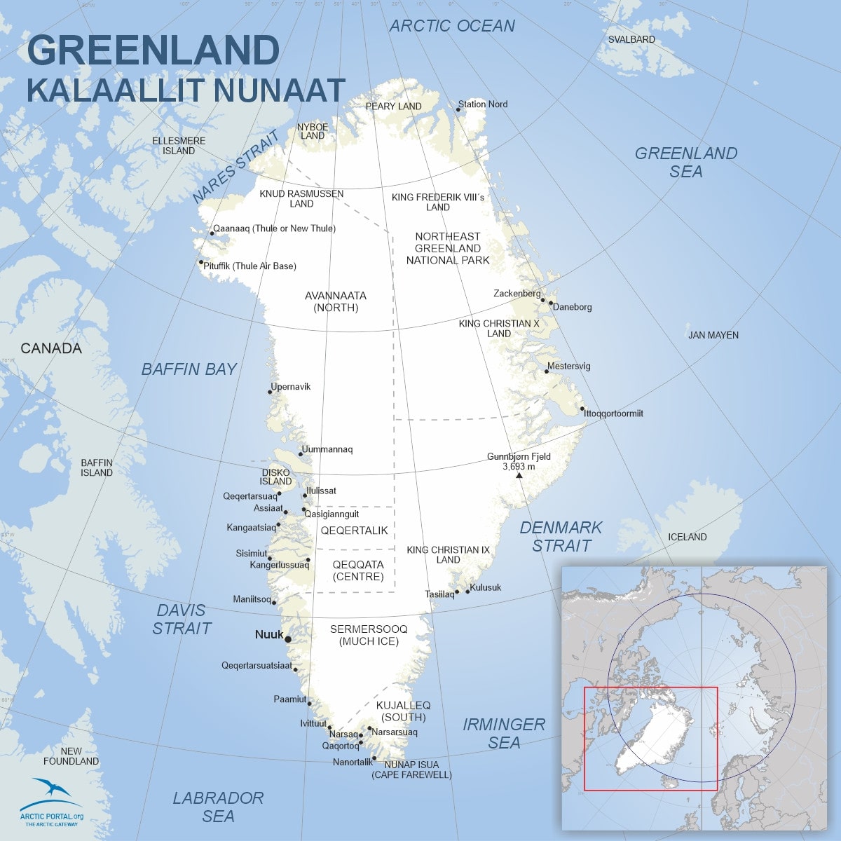
This is a map of Greenland. Greenland is about 2,17M km2. Inland ice and glaciers cover about 1,76M km2. Two-thirds of the country lies above the Arctic Circle, experiencing a frigid climate year-round. The island's unfrozen areas are characterized by tundra landscapes, with permafrost lying beneath much of the surface. The coastline, mostly rocky, stretches for approximately 39,330 kilometers (24,430 miles), making it one of the longest coastlines globally. Highest point is Gunnbjørn's Fjeld 3,693 m.
Approximately half of Greenland's landmass is designated as the National Park of Greenland, being both the island's sole national park and the largest national park in the world. At 0,97M km2 (0,37M mi2), the park covers most of the NE section of the island.
© Arctic Portal 2006-2026
Last updated: February 2025
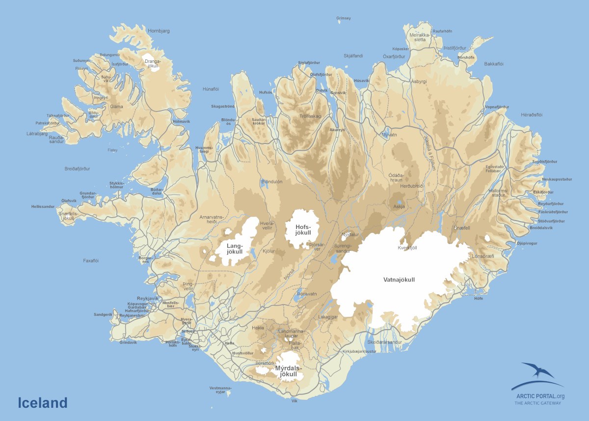
This is a map of Iceland. Iceland is a Nordic island nation covering about 103,000 square kilometers, with Reykjavík as its capital and largest city. Geologically, it sits on the Mid-Atlantic Ridge, making it highly volcanic and geothermally active. Formed from basaltic lava, Iceland features glaciers, geysers, and active volcanoes, with continuous land formation due to rifting and eruptions.
© Arctic Portal 2006-2026
Last updated: February 2025

