
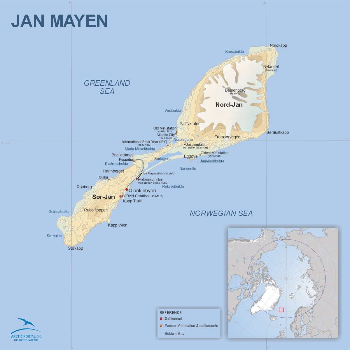
Jan Mayen
This is a map of Jan Mayen. Jan Mayen is a remote Norwegian island located at 71°N/8°W in the Arctic Ocean, about 600 kilometers northeast of Iceland, 500 km east of Greenland, and approximately 1000 km west of Norway. The island is approximately 55 km long from southwest to northeast and covers an area of about 373 square kilometers (see map).
The northeast part of the island, Nord-Jan, is home to Beerenberg, an active volcano that last erupted in 1985. It is the northernmost active volcano in the world and the highest peak in Norway's territories, standing at 2,277 meters (7,470 feet) above sea level. Beerenberg is covered with glaciers, while the southwest part of the island, called Sør-Jan, is flat and lacks glaciers.
© Arctic Portal 2006-2026
Last updated: February 2025
Source
Arctic Portal