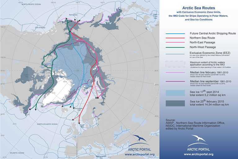
This map shows the main Arctic Sea Routes, Sea Ice Conditions (summer and winter ice 2014/5; median line 1981-2010), Exclusive Economic Zones limits and the area covered by the IMO Code for Ships Operating in Polar Waters, known as Polar Code (IMO Delimitations).
© Arctic Portal 2006-2026
Last updated: April 2016

Source
Arctic Portal, NSIDC, AMAP, Northern Sea Route Information Office, IMO

