
Arctic Sea Routes with main ports and sea ice extent in February and September 2025
This map shows Arctic Sea Routes with main ports and sea ice extent in February and September 2025.
This map includes: Future Central Arctic Shipping Route, Northern Sea Route, North-East Passage, North-West Passage, the Arctic Circle, Sea Ice Extent February 2025 and September 2025, Exclusive Economic Zones and International Waters / High Seas.
The map is using Northpolar Russia projection
© Arctic Portal 2006-2026
Last updated: January 2026
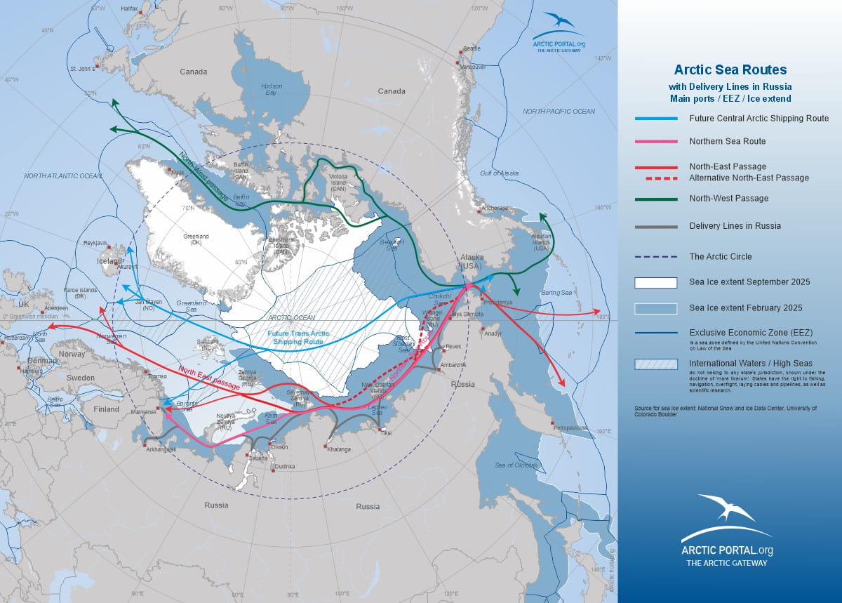
Source
National Snow and Ice Data Center, University of Colorado Boulder